Celebrating 15 Women Shaping the Future of Earth Science
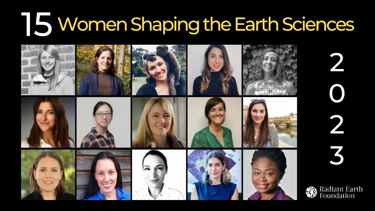
Meet the women shaping the future of Earth Science
Happy International Women’s Day!
As we work to create a more inclusive and diverse Earth Science community, today is an important day to recognize exceptional women who are pushing the boundaries of their fields and shaping the future of Earth science. Nominated by their peers, these women have made significant contributions to science through their innovative research, pioneering discoveries, and groundbreaking work, all while fostering an inclusive community. They come from diverse backgrounds and have a wide range of expertise, but they share a common goal of advancing shared understanding of the Earth and its complex systems.
In the spirit of open science, in the “Year of Open Science,” we are particularly happy to highlight women who have demonstrated a commitment to transparency, collaboration, and the free sharing of scientific data, methods, or results in their work.
Rhiannan Price (United States)
Rhiannan Price is a Principal Consultant and Managing Director of Inclusive and Sustainable Development at DevGlobal Partners, and the former Director for sustainable development practices at Maxar Technologies. With over 15 years of experience working at the intersection of technology and development, Rhiannan is passionate about using her expertise to positively impact the world. One of her recent achievements includes leading a team of data scientists to digitize 1.2 million buildings for the Replicable AI for Microplanning (Ramp) research project. This work has resulted in valuable training datasets that are now available for download with open licenses and has the potential to improve microplanning processes in the health sector.
Rhiannan holds a master’s degree in International Human Rights from the University of Denver and is fluent in French, Swahili, and Creole. Her linguistic skills have allowed her to connect with communities across the globe, and she is deeply committed to promoting inclusive and sustainable development practices. Rhiannan enjoys hiking and volunteering with local environmental organizations. You can follow her work and stay updated on her latest projects by connecting with her on LinkedIn and Twitter.
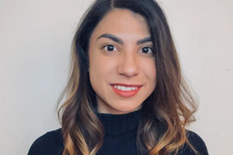
Aimee Barciauskas (United States)
Aimee Barciauskas is a Data Engineer at Development Seed, passionate about using technology to create positive social impact. With a strong software engineering and data science background, Aimee specializes in developing cloud-native solutions for geospatial data processing and analysis. Currently, she is working on the Cumulus project, which aims to make NASA’s EO data more accessible and usable through cloud technology. Her contributions to the project include developing APIs, improving the scalability of the cloud infrastructure, and adding features to the data processing pipelines.
Aimee’s work has helped to advance open standards for geospatial data processing, storage, and analysis. She holds a Master’s degree in Data Science from the Barcelona School of Economics. She is a chapter leader of DataKind DC, where she volunteers on projects that use data science to solve social problems. Her projects range from developing a program referral portal for DC’s Child Family Services Agency to using natural language processing to understand the philanthropic motivations of donors. Follow Aimee on GitHub and Twitter to keep up with her work and stay up-to-date with her interest in programming, data architecture, and machine learning.
Lisa-Maria Rebelo (Kenya & Sri Lanka)
Dr. Lisa-Maria Rebelo is a renowned remote sensing specialist with 20 years of experience working in Africa and Asia. She is currently the Lead Scientist of Digital Earth Africa and is passionate about leveraging technology to improve natural resource management. Her work is characterized by technical expertise, innovation, and an open-minded approach to addressing challenges. Lisa-Maria is committed to scientific rigor and ensuring that her research provides trusted input into policy.
Lisa-Maria’s research focuses on the development of innovative EO-based tools and applications. Her contributions include wetland inventory, assessment, and monitoring, key performance indicators for agricultural water use and productivity, and integrating ICT-based tools and applications. She has also led the development of widely used water accounting tools. She is a key Global Mangrove Watch team member, which generates globally consistent mangrove maps using automated methods.
Lisa-Maria strongly advocates for open science and has made several contributions. She has authored publications in open-access journals and made datasets and software openly available through platforms such as the CSIRO Data Access Portal and GitHub. She also serves on various scientific advisory groups, including as Vice Chair to the Ramsar Conventions’ Scientific and Technical Review Panel, as Principal Investigator and wetlands coordinator for the Japanese Aerospace Exploration Agency’s science team, and as a panel member to the Global Ocean Observing System biology and ecosystems panel.
Born and raised in Nairobi, Kenya, Lisa holds a Ph.D. in remote sensing from University College London. Follow Lisa-Maria on Google Scholar and LinkedIn to stay updated on her latest research and work.
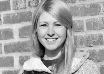
Thaïs Bendixen (Germany)
Thaïs Bendixen is a multilingual, multicultural Geologist turned Data Science Engineer at UP42. With a deep passion for using EO data with ML to create a positive societal impact, Thaïs has dedicated herself to sharing her knowledge and expertise with others.
Thaïs strongly advocates gender equality in the tech industry and has organized meetups to mentor women. She has partnered with groups such as Pyladies to create a supportive environment where women can learn and grow. Thaïs is also committed to teaching underrepresented groups about the tools and skills she has learned throughout her career. In 2022, Thaïs was part of the team that proposed the creation of SpatioTemporal Asset Catalog (STAC) standards for tasking satellite data. She firmly believes that STAC guidelines will greatly support ML4EO, enabling more efficient and effective data analysis for various applications.
Thaïs is a gifted communicator with a contagious energy that makes even the most complex topics easy to understand. Follow Thaïs on Twitter and LinkedIn to stay updated on her latest research and work.
Roshanak Darvishzadeh (The Netherlands)
Dr. Roshanak Darvishzadeh is an Associate Professor in the Department of Natural Resources, Faculty of Geo-information Science and Earth Observation. Her research focuses on quantitative remote sensing for mapping and modeling plants’ biophysical and biochemical traits at leaf and canopy levels. She uses remote sensing data from various platforms to assess vegetation growth, health, disease, and abiotic and biotic stress factors with applications in agricultural and natural ecosystems. With over 20 years of experience, Roshanak is a well-respected researcher in remote sensing.
In addition to her research, Roshanak is an active member of several national and international professional associations. She is passionate about fostering equal opportunities for women in EO science. She works towards this goal in her daily activities, including education, research activities, and mentoring and supervising MSc and Ph.D. students.
Roshanak has made significant contributions to the field of open science. Her publications in open-access journals indicate a commitment to making research more accessible to a wider community. She has also published numerous articles on data sharing and open data, promoting transparency in research and making data available to others for reuse and replication. Her research has been cited over 4700 times. She has also contributed to the critical aspect of reproducibility in research by promoting transparent research practices, such as sharing data, code, and materials. To learn more about Roshanak’s research, you can follow her on Google Scholar.
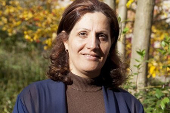
Chinwe Ifejika Speranza (Nigeria & Germany)
Dr. Chinwe Ifejika Speranza is an accomplished geographer and researcher who has significantly contributed to sustainable development and open science. She is a professor and Unit Leader at the University of Bern in Switzerland. Her research focuses on the social and economic dimensions of sustainable development, climate change adaptation, and food security. Chinwe has published extensively on these topics in several academic journals and has contributed to several reports and policy briefs, including the IPCC’s Fifth Assessment Report and the FAOs State of Food and Agriculture report.
Chinwe’s contributions to open science include publishing numerous articles in open-access journals, sharing her data and research tools openly, and being involved in initiatives that promote open access to research data and tools. Her field experience spans over 20 years in Kenya, Nigeria, and Switzerland and various experiences in West- and East Africa. She holds a Ph.D. in Geography from the University of Bern. To learn more about Roshanak’s research, you can follow her on Google Scholar.
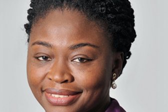
Brianna R. Pagán (United States)
Dr. Brianna Rita Pagán is a highly accomplished researcher and educator in the field of biology, with a passion for environmentalism and making science accessible to the masses. With over a decade of experience working on various environmental efforts across the United States and abroad, Brianna has established herself as a leader in the field. Currently, she serves as the Lead Development Engineer at NASA’s Goddard Space Flight Center, where she is responsible for overseeing the transition of the agency’s services to a cloud-based infrastructure and managing several engineering teams.
Brianna earned her Ph.D. in Bioscience Engineering from Ghent University, where she conducted research that was published in several high-impact journals, such as Nature and Science. Her work has also been featured at several national and international conferences, where she shared her expertise and insights with fellow researchers and industry professionals.
In addition to her work at NASA, Brianna is an enthusiastic science communicator dedicated to making complex scientific concepts accessible to a wider audience. To stay updated on her latest research and work, follow Brianna on LinkedIn and Twitter.
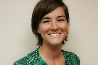
Meghan Halabisky (United States)
Dr. Megan Halabisky is a remote sensing ecologist with Digital Earth Africa who studies the Earth’s dynamic patterns and processes through data collected by multiple satellite and aerial sensors. With a background in conservation and management and a concurrent master’s degree in public policy and governance from the University of Washington, Meghan holds a Ph.D. in landscape ecology and remote sensing from the UW School of Environmental and Forest Sciences. Her passion lies in making EO products more accessible to practitioners, policymakers, and end-users to ensure they are fit for purpose, easily understood, and have a significant impact.
Megan’s research has informed conservation efforts in the United States, where she began her career as a conservation manager in Hawaii. She has since led the development of methods to map wetlands, vegetation biomass, and associated carbon stock, applying machine learning to multispectral, radar, and lidar data. Her work has provided valuable information for sustainable development in Africa. She leads continent-wide collaborations to validate EO-derived information products for surface water mapping and cropland classification.
Megan is dedicated to diversity and inclusion in the EO and remote sensing communities. She is a contributing member of Ladies of Landsat, an initiative that raises awareness of diversity issues and promotes women in the geospatial industry. You can follow her on Google Scholar and LinkedIn to learn more about Megan’s research.
Annemarie Schneider (United States)
Dr. Annemarie Schneider is a trailblazer in urbanization and land cover change. An Associate Professor at the Nelson Institute’s Center for Sustainability and the Global Environment, her research focuses on the human dimensions of these complex issues, exploring the demographic, economic, and policy changes responsible for rapid urbanization and urban sprawl. This is in addition to researching the environmental impacts that result at both the local and global scales.
One of Annemarie’s most significant achievements is creating the first global urban map at 250 m resolution. This map has inspired many follow-up projects in the past decade. It has been used by researchers, policymakers, and organizations worldwide to understand better the impact of urbanization on the environment and society. A passion for making a difference drives Annemarie’s work. She believes understanding the complex interactions between people and the environment is crucial for creating a sustainable future.
Annemarie has earned her Ph.D. in Geography and Environment from Boston University. Most of her research publications are open access, enabling free access to anyone who wants to read or cite them. You can follow her on Google Scholar and LinkedIn to learn more about Annemarie’s research.
Heather Couture (United States)
Dr. Heather Couture is an Applied Research Consultant, Podcast Host, and Writer. A leading expert in machine learning, her experience spans 20 years in academia and industry.
Her contributions and insights are in applying deep learning for remote sensing, particularly being aware of Earth science and physics. This area has only recently been paid attention to by researchers. Heather is passionate about helping startups reduce the trial and error of machine learning model development. She understands the frustrations of teams struggling to keep up with the rapidly changing field and data challenges, such as noisy labels and small training sets. Through her website, pixelscientia, she offers consulting to help startups build robust and generalizable models that produce valuable insights.
Heather’s work has significantly impacted the field of machine learning. She has collaborated with a team at the University of North Carolina to study predictive modeling of breast tumors from H&E histology, which can lead to improved treatment decisions. She also led efforts to estimate GHG emissions from sources on Earth using satellite imagery to support climate change. She shares her knowledge through her Impact AI podcast and Computer Vision Insights Newsletter. With three patents granted and one pending, Heather’s contributions to the field of ML will continue to make an impact for years to come. To stay updated on her latest research and work, follow Heather on LinkedIn.

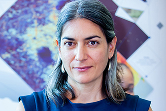
Maria Molina (United States)
Dr. Maria Molina is an Assistant Professor at the University of Maryland (UMD), conducting groundbreaking research on the intersection of ML and atmospheric science. She is also an Affiliate Faculty at the UMD Institute for Advanced Computer Studies and an Adjunct Assistant Professor at North Carolina State University.
Maria’s research focuses on using ML to understand extreme weather events, such as severe convective storms. Her work has the potential to shed light on the causes and consequences of these phenomena and inform future climate modeling. She also investigates the applicability of ML to Earth system predictability, exploring how these tools can help us better understand the sources and limits of predictability across different timescales.
Maria leads a group of undergraduate and graduate students in research across atmospheric science and computer science, serving as an excellent mentor and role model for early career scientists. Additionally, she is actively involved with various committees of the American Meteorological Society, including serving as Vice-Chair of the AMS Committee on Artificial Intelligence Applications to Environmental Science and a member of the AMS Board on Representation, Accessibility, Inclusion, and Diversity.
Maria is characterized by her commitment to open science practices, interdisciplinary collaborations, and stakeholder engagement. By leveraging cutting-edge technology and collaboration, she is at the forefront of climate science research with great societal relevance and importance. You can follow her research on Google Scholar and LinkedIn to learn more about Maria’s research.
Lujia Feng (China & Singapore)
Dr. Lujia Feng is a Geodesist with a diverse academic background in geology, geophysics, and atmospheric science. She is currently the Principal Research Fellow at the Earth Observatory of Singapore. With a passion for Earth and Atmospheric Sciences, Lujia has conducted extensive research focusing on using the Global Navigation Satellite System (GNSS) to study natural hazards related to climate, earthquakes, and volcanoes. Her current research uses atmospheric water vapor information collected by the GNSS to understand climate hazards and climate change better.
Lujia’s commitment to open science is evident in her transparent approach to research. She has made her research publications and data readily available to the public, promoting transparency and reproducibility in scientific research. Her dedication to open science has made a significant impact in the field of geodesy, allowing for greater access to data and knowledge, thereby advancing the understanding of Earth and atmospheric sciences. To learn more about Lujia’s research, you can follow her research on Google Scholar and her website.

Maja Schneider (Germany)
Maja Schneider is a Research Associate in Machine Learning in Earth Observation, currently pursuing her Ph.D. at the Technical University of Munich. Her passion for the intersection of computer science, electrical engineering, and geodesy led her to complete her undergraduate degree at the Munich University of Applied Sciences, where she was exposed to the limitless possibilities of remote sensing technology.
As a dedicated researcher, Maja has made significant contributions to the field of ML4EO. She has published her research in several reputable journals and conferences, demonstrating her ability to tackle complex challenges and provide innovative solutions. Her work uses ML to improve our understanding of the world, particularly emphasizing climate change, agriculture, and natural resource management.
Maja is an active research community member and maintains a strong online presence, regularly sharing her latest research and insights on LinkedIn and Twitter.
Denise McKenzie (Australia)
Denise McKenzie is an experienced strategic advisor, partnership builder, and presenter with over 20 years of experience. She is the Community & Ethics Partner at PLACE, a non-profit mapping organization that believes high-quality mapping is essential data infrastructure for the digital age. In this role, Denise leads the development of the global membership and partner program that use the data collected in the PLACE Trust and promotes the uptake and use of the Locus Charter, which she co-authored through her previous role as co-director of the Benchmark Initiative.
Denise’s broad range of experience includes working in domains such as agriculture, defense, sustainability, insurance, Smart Cities & IoT, statistics, development, and data ethics. She previously worked with the Open Geospatial Consortium, serving as Head of Communication and Outreach and leading work on the UN-GGIM Geospatial Standards Guides and strategic partnership engagement. Denise also holds the chair-Emeritus of the board of directors for the Association for Geographic Information in the United Kingdom (UK). She serves as a steering committee member for Women in Geospatial+.
Denise holds a Master of Science in Sustainability from the University of Southampton in the UK. To learn more about her work, follow her on LinkedIn and Twitter.
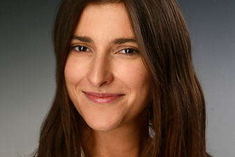
Amber Kremer (United States & Peru)
Amber Kremer is an experienced Project Leader in youth engagement initiatives across the Americas and is currently supporting the AmeriGEO Pathways program for young scientists and professionals in geospatial sciences, as well as Climate Adaption and Capacity Development initiatives across the Latin America and Caribbean region. She is also a graduate student in Natural Resources management focusing on tropical rainforest ecosystems at Oregon State University. Amber has made significant contributions to the field with her expertise in ArcGIS Suite, Python and R Software, Adobe Suite, remote sensing, and photointerpretation. She is committed to opening doors and leveling the playing field for students and young professionals.
Amber has helped Peruvian and Paraguayan space agencies establish GEOPathwys programs that inspire students to pursue careers in geospatial data sciences. Her exceptional oral and written communication skills allow her to effectively collaborate with multicultural teams and establish lasting relationships with partners. She co-leads the organizing committee for 2023 AmeriGEO Week in Costa Rica. To learn more about her work, follow her on LinkedIn.